MGWR

MGWR Logo

MGWR is a new release of a Microsoft Windows & MacOS based application software for calibrating both multi-scale as well as traditional geographically weighted regression (GWR) models, which can be used to explore geographically varying relationships between dependent/response variables and independent/explanatory variables.

GET THE SOFTWARE

MAP OF DOWNLOADS

COLLABLOCATION

GWR4 Logo

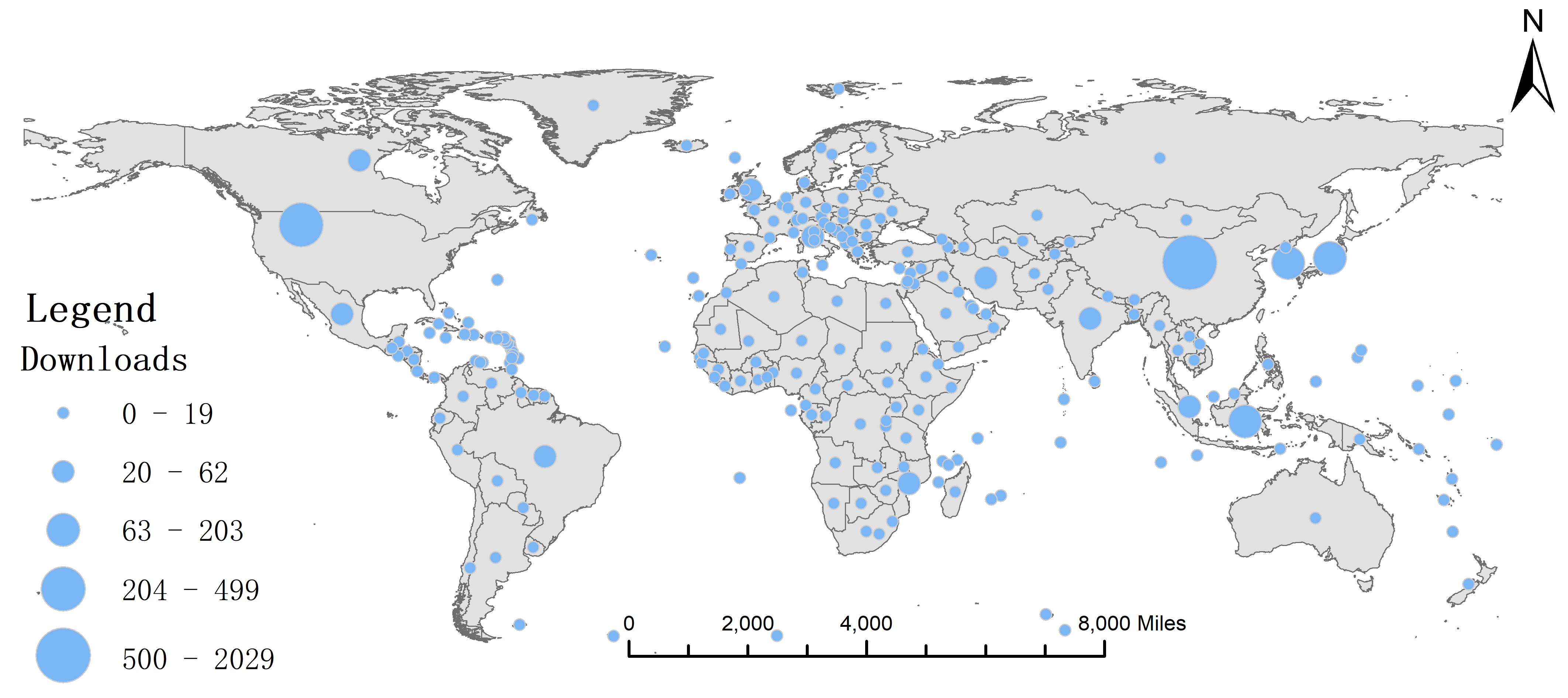
Collablocation is a free, open-source geodesign platform for facility location problems. Collablocation extends geodesign from its roots in land-use planning to facilities such as fuel stations (our first application), schools, fire stations, or virtually anything that can be represented as a set of points on a map.
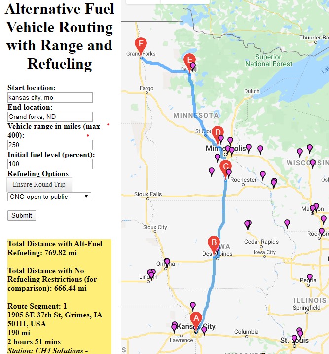
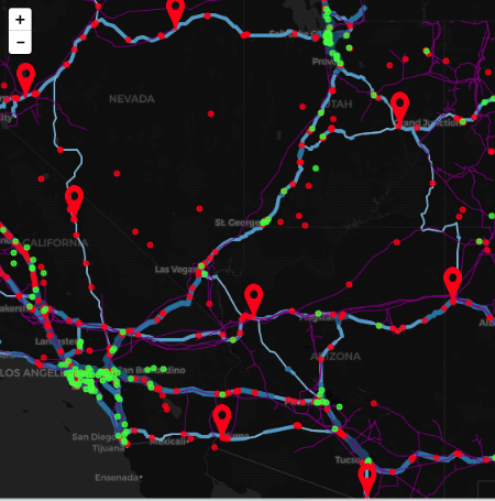
 

TRY COLLABLOCATION

AFV ROUTING

AFVROUTING

AFVROUTING is a prototype route mapping website that calculates and displays, with a single click, the best driving route given the type of fuel, the available stations, and the vehicle’s driving range. This prototype is for CNG and Hydrogen stations in 2014.


TRY AFVROUTING NOW